

For more than 55 years, Cataraqui Conservation has played a significant role in flood prevention and the disseminating of flooding information to residents and stakeholders within the Cataraqui region. Mandated this role by the Province of Ontario, Conservation Authorities protect people and property from flooding. The goal of the Flood Forecasting and Warning program is timely and well-documented flood messaging pertaining to safety concerns and potential flooding impacts.
More succinctly, Cataraqui Conservation is responsible for monitoring and predicting flood flows and water levels within our jurisdiction, operating water control structures such as dams to manage water levels and disseminating flood messages to local municipalities, agencies, and the public.
As outlined in a previous Snow Survey Article, there is no longer any one season affiliated with flooding. For decades, like clockwork, an excessive spring melt might be expected to lead to flooding downstream. With the advent of climate change, these melts sometimes happen multiple times through the winter, and with more extreme storms happening in the summer months, sudden flooding can also happen more during the warmer times of year.
The snow survey still does act as a significant indicator of this spring ‘freshet’ that will happen in March and April and a meaningful contributor to flood forecasting over a short and longer term, as well as influencing dam operations for the organizations that own and manage dams in the region, including Parks Canada, Ministry of Northern Development, Mines, Natural Resources and Forestry (NDMNRF), Portage Power, and Cataraqui Conservation.
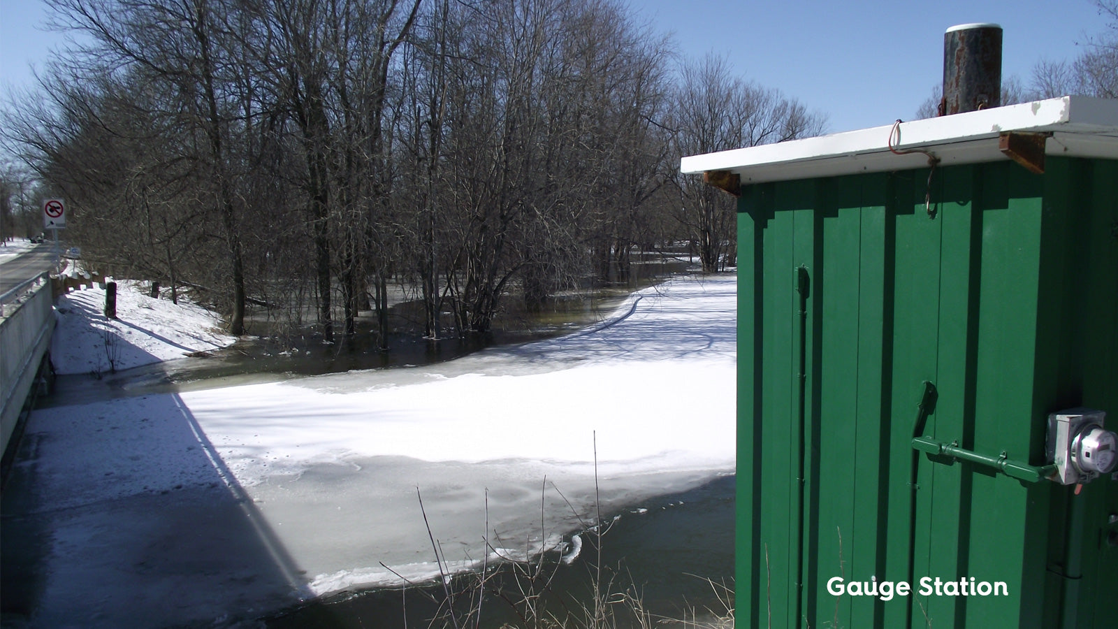
“Our role in flood prevention is to assess current watershed conditions and forecast future conditions to inform our flood risk assessments and messages to the public and our partner municipalities (who are the ones responsible for the on-the-ground flood response and mitigation efforts, including providing sandbags). There are hundreds of lakes in our region, and many connecting waterways, meaning the entire watershed is interconnected,” said Shawn Fairbank, Technologist, Water Resources for Cataraqui Conservation, adding that there are hydrometric gauge stations located strategically throughout the watershed to measure water depth as well as river and stream flows.
“With documentation from past high-water events we can try to correlate forecasted flows with potential negative impacts. We do this every day, running what is called a DPC or daily planning cycle, which looks at conditions such as current creek levels, assumed ground conditions, precipitation and temperature forecasts, and several other factors that need to be considered to forecast creek flows. A significant amount of rain in the forecast, or a substantial, rapid warm up during the spring freshet (melt) would trigger a closer look. Following a significant rainfall event, water levels on creeks can take days to get to their peak and then days to recede. It takes even longer for lakes to complete this process. Water Safety statements can be necessary in the winter to advise of high flows and deteriorating ice conditions. Flood Outlook statements may also be warranted. The timing and severity of the messaging is dependant on many factors such as winter rainfall events, which are more impactful due to the higher runoff from frozen ground.”
When flooding is possible, or about to occur, Cataraqui Conservation issues flood messages to municipal emergency management officials, the media and the public. In a flooding emergency, municipalities take the lead as they are responsible for emergency response under provincial legislation. Each municipality has an emergency response plan which deals with many situations including flooding.
The decision of whether to issue flood messaging is led by Cataraqui Conservation staff and informed by input from the aforementioned group of water control structure operators (Water Managers).
“Cataraqui Conservation hosts meetings with the group of Water Managers (February – April) to discuss current conditions on inland watercourses and managed lakes, the coordination of dam operations and appropriate flood messaging. These meetings are typically every two weeks, and more frequently during especially critical times. Daily communications occur in addition to these meetings.” Fairbank said, adding that these discussions do not include the Lake Ontario shoreline or St. Lawrence River which are managed by the International Lake Ontario-St. Lawrence River Board (ILOSLRB), who develop and issue their own water level forecasts. Cataraqui Conservation flood messaging for Lake Ontario and St. Lawrence River is informed by ILOSLRB forecasts and documentation of negative impacts from past high-water events.

There are five flood message types that Cataraqui Conservation may need to send out for inland lakes and streams:
- Normal: no flood conditions exist.
- Watershed Conditions Statement - Water Safety: high flows, unsafe banks, melting ice or other factors that could be dangerous for recreational users such as anglers, canoeists, hikers, children, pets, etc. Flooding in not expected.
- Watershed Conditions Statement - Flood Outlook: early notice of the potential for flooding based on weather forecasts call for heavy rain, snow melt, high wind or other conditions that could lead to high runoff, cause ice jams, lake shore flooding or erosion.
- Flood Watch: Flooding is possible in specific watercourses or municipalities. Municipalities, emergency services, and individual landowners in flood-prone areas should prepare.
- Flood Warning: Flooding is imminent or already occurring in specific watercourses or municipalities.
In recent years, it’s not just excessively high water that has caused problems, but low water is also a concern, especially during the summer months. As well as having a system to warn watershed residents about the possibility of inland flooding on rivers and lakes, there is also a warning system in place to let residents, municipal partners and other stakeholders know that there is the potential – or reality – of a drought occurring.
“These low water events can happen in the same years as high-water events which make dam operations more difficult. As you are dealing with such extremes, it’s important to capture as much water as possible so that it can be used throughout the summer if it’s a particularly dry summer. This can be especially critical in the case where the dam acts as a reservoir to augment flows for downstream water users such as the Wilton Road Dam on Millhaven Creek. But then you also don’t want to go too far overboard in keeping the water levels high (through the dams and other water control structures) because of the more frequent extreme rainfall events and associated operational difficulties. Those extremes mean more operations, and more documentation of what’s happening every year in order to help learn from the past and prepare for future years,” Fairbank explained.

It's very difficult to provide much forecast lead time on how a particular spring freshet will go. Weather forecasts are often uncertain and variable. There are, however, certain factors that increase the risk of a more problematic spring freshet occurring, such as higher than average snowpack and layers of dense snow and ice that can lead to higher runoff rates during rainfall and melt periods, as opposed to infiltrating harmlessly into the ground. The prognosis for spring freshet 2022 included a combination of these factors leading to some concern. Accordingly, a Flood Watch was issued for areas on the Gananoque River System. One of the main factors is the amount of rain that occurs coinciding with peak flows from snow melt runoff. This key factor cannot be forecast much in advance. Reviewing the combination of factors and resulting water levels and flows in previous years is one tool that assists in determining current flood risk. We look for patterns that may be forming that look familiar.
As always, forecasted rainfall is the main determining factor of whether flood messaging needs to be issued and specifically which severity.
For more information, visit https://cataraquiconservation.ca/pages/flood.
Each of these organizations plays an important role in water control/management within the region:
For inland lakes and streams, Portage Power manages dams in both the Cataraqui River Watershed (including lakes that are tributary to Parks Canada-managed dams on the Cataraqui River) and on the Gananoque River System. Parks Canada manages dams in the Cataraqui River Watershed along the Rideau Canal (aka Rideau Waterway). The NDMNRF manages dams on the Gananoque River System tributary to Portage Powermanaged dams. Cataraqui Conservation manages dams on various watersheds in the western and eastern portions of the region.
For the Great Lakes and St. Lawrence River, the International Lake Ontario-St. Lawrence River Board (ILOSLRB) manages outflows from structures along the Great Lakes System, including the Moses-Saunders Dam on the St. Lawrence River in Cornwall.
Cataraqui Conservation incorporates information from the above-mentioned water management groups into flood messaging pertaining to inland lakes & streams and Lake Ontario-St. Lawrence River shorelines.
Cataraqui Conservation’s Flood Forecasting and Warning mandate is specific to riverine areas (inland lakes and stream) and Lake Ontario-St. Lawrence River. This does include flooding of rivers, creeks and streams that pass through urban areas when their banks become overwhelmed. However, urban flooding is not part of Cataraqui Conservation’s mandate (i.e., ponding on urban roadways due to overwhelmed drainage infrastructure, localized basement flooding in urban areas, etc.). Utilities Kingston and municipalities can provide information about the various causes and mitigation measures associated with basement flooding.
